Hiking Mt. Charleston's Cathedral Rock Trail
Visiting the area around Mt. Charleston was a new experience for both of us. I've been up to the area before (on some less-traveled slope my dad, as is his fashion, drove his truck up to), but never with Michelle.
It takes 30-45 minutes to get to the base of the mountain from Las Vegas. Take US-95 north to SR-157 (Kyle Canyon). SR-157 climbs from about 2,000 feet to 7,000 feet, and then the trails begin.
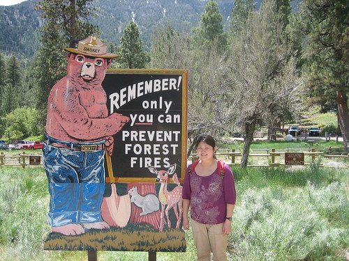
We stopped at the welcome center for some information on the trails.
We opted for a hike up to Cathedral Rock, which is about 1.4 miles each way, and climbs to just over 8,000 feet.
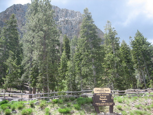 The trailhead has a sign, and you can see, beyond and above the trees, the trail's namesake. You actually do end up on top of this, which is hard to believe when you're down below. Some of the signs on the trail are less than helpful. They feature two arrows, one pointing in each direction of the trail split and are labeled "<== Trail ==>". Uh, ok. We went the wrong way one time, and on our way back we saw a group of 3 girls coming down from the same wrong path. For future reference, the first time you see this sign you need to go to the left, down towards the gravel-covered loop.
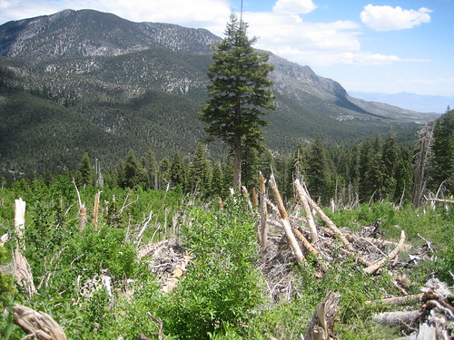
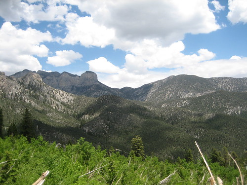 Higher points on the trail offer views of the surrounding mountains. We also noticed a line of bent and broken trees. Some trees, still standing among the fallen, were missing branches below a certain point. It seems an avalanche or flash flood of some kind wrecked the area at some point a few years ago. Leave a comment if you know what happened.
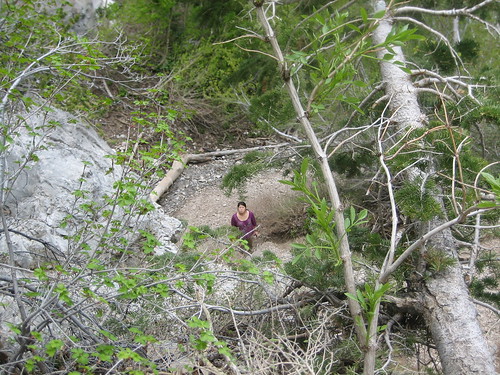
Further up the trail we found a small waterfall. It's probably more amazing in the spring, but to be flowing (and have snow under it!) around the end of May was pretty amazing.
 I scrambled up the rock by the side of the waterfall to see if the basin was deep and full of water. I left Michelle behind, so of course when I finally start to come back down I see her looking for me, mouthing something sweet about "don't go where I can't follow". I insist this isn't Lord of the Rings and we hug and continue the hike.
Much of the trail is gravel-like. It's an easy walk, but the broken rock isn't always the surest footing. We saw a few people on this trail, a mix of couples and various groups of women, some walking with their dogs. We asked one couple if we were on the right path, because it felt like we had walked more than a mile and the trail didn't seem to be anywhere near ending.
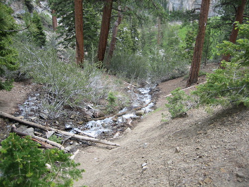
As the trail wrapped around the mountain and climbed higher, we found a second source of water, this time coming from a drain pipe (natural water, just re-routed).
We lost the trail a little at this point. There are several options going in different directions. We took a small trail up an increasingly difficult slope. The path was broken rock, and as we climbed higher we realized it'd be a bitch to come back down. I ran ahead to make sure we could do it and found that the path we were on joined the "official" path about 20 feet above our heads.
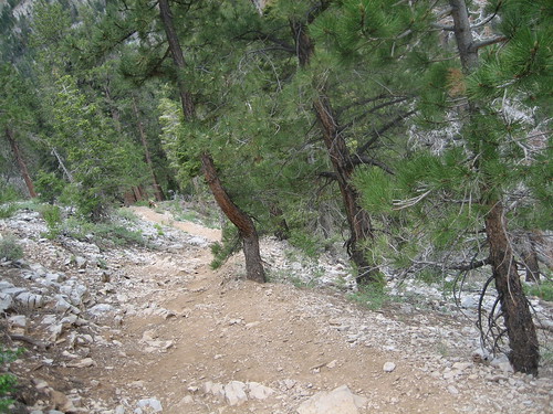 This is the official path. We were on the rocky slope off to the right.
We met the couple we had asked a question of earlier as they were coming down. We talked a little and the wife pointed out Mt. Charleston to us, in the distance. Her husband had led a church group up there before for an overnight stay.
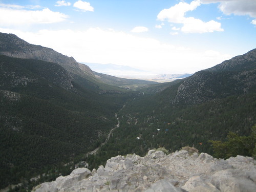
We finally reached the top and had it to ourselves for about 15 minutes. The view is great, and you're encouraged to be careful near the edges as it's fairly easy to die.
 Ski lodges and homes below.
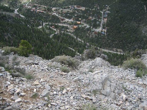
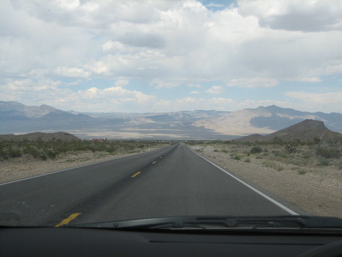
 The road leading into Mt. Charleston. Vegas is down in the valley.
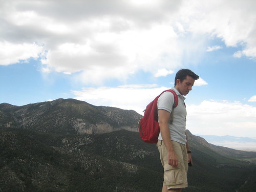 Me, topside.
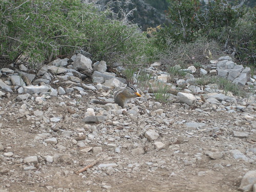
We saw a web full of caterpillars. We also saw chipmunks roaming around, and one ate a frito we dropped/threw at him.
 .
.
Our descent was rapid. It takes 30 minutes to walk down, and if you hop in your car and drive down the mountain you can essentially go from 8,000 feet to 2,000 feet in less than an hour.
This presented a problem for Michelle. She had a headache on the trail, and though we had a couple bottles of liquids, I don't think she drank enough. After we got back into town and stopped at Weinerschnitzel for food (novelty, old times), her headache seemed to get worse.
Back at my Dad's house she slept for 30 minutes and then we drove out into the heat to pick Renee up from work. The heat exacerbated her condition, and by the time we got back home she was nauseous. Soon she retched quite horribly. We were on the verge of taking her to the hospital, but she rested more and started feeling better after clearing her stomach.
While she was a little sicker than I was in Peru (at about 11,000 feet), she handled the elevation pretty well. What happened to her in the mountains seemed to be a product of rapid elevation changes, exertion, dehydration, and possibly food poisoning (or just too much grease). And then some nasty Vegas heat.
There's no entry fee to drive up the mountains, and there are plenty of awesome trails. Hopefully we can hike more of them later. It'd be great to be within driving distance of a good mountain range year round.


